
Listen to this reflection by playing the video below or continue down the page to read the full text version.
This week, I completed a thru-hike at Pictured Rocks National Lakeshore along Lake Superior. It was my intent to make this my first multinight hike and test my endurance carrying the full weight of a forty-pound backpack.
For me, it is much more enjoyable to hike with someone, but the pool of available friends and relatives to take a forty-two-mile multiday hike through the wilderness is small. Fortunately, my cousin Paul was available and up to the challenge. He accepted my invitation to accompany me on this journey.
Although not a hiker himself, Paul has completed multiple marathons, so we were confident he would be able to complete the four-day, three-night hike. The first challenge was procuring light weight hiking gear. He needed a tent, sleeping bag, sleeping pad, and backpack. I was able to borrow most of these items from generous neighbors—thank you, Dana and Thomas. I found a tent in the return bin at REI at a small fraction of its cost new.
A couple of nights before our trip, I set out all the items we needed on my basement floor and double-checked our gear. I charged my Garmin InReach Mini satellite GPS communicator and attached it to my bag. When everything was packed, my backpack weighed in at exactly forty pounds while Paul’s weighed in at thirty-five.
The plan was for us to embark from Munising Falls on the North Country Trail heading east toward Grand Marias. We would cover approximately twelve miles each of the first three days and six miles on the final day. Total mileage was forty-two miles.
The weather was perfect with just the haze from the Canadian wildfires keeping it from being a perfect start. We were on the trail by 9:15 a.m. with a goal of making our first campsite at Mosquito River by 3:00 p.m. It seems like any hike I take the first mile is always uphill. This was no different. We anticipated the first few miles would be through the deep woods with little to see, so we set a brisk pace to eat up some of the miles. Day one was uneventful with little to note. I would have preferred the trail to be better marked with blazes, but I am not sure if the National Park Service allowed them. It created confusion from time to time as trails intersected with no clear markings.
We made Mosquito River with relative ease a little after 3:00 p.m. We set up camp after spending about fifteen minutes searching for the correct site. For some reason, site four was the only site not listed on the map. We finally came across a site with the number four scratched onto the marker by previous campers.
Mosquito River was busy. Day hikers could get to it with a relatively short two-mile hike, and the kayak companies dropped off their clients in the vicinity, making for a very busy area. After a leisurely dinner and dip in the lake, we sat up talking. We were relieved that Mosquito River did not live up to its name as there were relatively few bugs at all. We hit the sack by 9:00 p.m. with another big day ahead of us.
The forecast for day two was for showers later in the afternoon. With that in mind, we broke camp early, hoping to reach our next campsite at Pine Bluff before the rain. We realized after an hour on the trail that the showers would arrive much earlier, as we saw some ominous clouds to our west. We donned our rain gear when the showers caught up to us, but it only rained for about an hour as the trail wound its way through the canopy.
Our pace was slowed as we circumvented numerous areas of mud. All morning, we made a steady climb through the woods and were finally rewarded when the trail leveled off at the top of Pictured Rocks’ majestic cliffs. The trail followed the edge of the cliff for the remainder of the morning with several spots where the trail edge literally dropped two hundred feet to Lake Superior. The views were breathtaking.
At one point, we came across a young buck with velvet on his antlers. He was making a meal of a root just off the edge of the trail. The trail went directly between the buck and a two-hundred-foot drop off. We were a little shy of trying to pass him that close to the edge of the cliff, but he refused to yield. I could have reached out and petted his nose as I slowly passed him. The root must have been a delicacy because our passing did not dissuade him from continuing his meal!
Late that morning, we reached Grand Portal Point. I can best describe this spot as a quarter-mile sandy ledge. It was beach-like, but with a two-hundred-foot drop to Lake Superior. The rain broke and it started to clear, so we pulled out our chairs and lingered for over an hour. Only one other hiker came through during that time, so we had the view all to ourselves.
Later in the afternoon, we took a break on a similar shelf near Spray Falls and met two families and their grandfather who were making a shorter trek. It was nice to share the view and stories of our journey to date. The towering cliffs morphed to elevated sand dunes as we made our next campsite, Pine Bluff, by 3:30 p.m. Paul and I were both a bit gassed, so the sandy beach near our campsite was a welcome respite to wash some of the days grime away. At this point, the beach stretched for miles.
That night, we met two families from the Cincinnati area and a couple from just east of St. Louis around the communal fire ring. We enjoyed their company. By 9:00 p.m., or hiker’s midnight, we all headed off to our tents to recharge for the following day.
Day three dawned with a promise of perfect weather. We had a leisurely breakfast before we hit the trail. Since the trail hugged the shoreline of Lake Superior, Paul and I decided to walk the beach for as long as we could before rejoining the trail. We managed to hike two miles on the water’s edge with just the sound of the lapping waves to keep us company before we had to rejoin the trail.
We once again decided to take extended breaks every three or four miles to rest up and hydrate. Twelve Mile Beach and Hurricane River were nice stops as the accumulated mileage began to cause fatigue. Reaching our campsite at Au Sable East around 4:00 p.m. was welcome as we had clocked a total of thirty-six miles.
That night, we met four couples from Toronto around the communal campfire and shared our stories. Ironically, they were doing the exact same hike at the same campsites, but in the opposite direction. We turned in early around 8:30 p.m. with plans to get an early start in the morning.
We broke camp around 6:45 a.m. and hit the trail. We managed to take in the early morning sun over Lake Superior as we headed east toward the dunes. Our final destination turned out to be 7.2 miles instead of six that morning. After hiking thirty-six miles, that extra 1.2 miles seemed somewhat unfair. The first mile was a grind, and we had to climb from lake level to the top of the dunes, a 350-foot ascent. We rested at the Log Chute to catch our breath for the final push. We resisted the temptation to descend the Log Chute after seeing a sign warning us that although the trip down was quick, it could take up to an hour to climb back up the dune.
With the end in sight, we hit the trail again. The trail was kind and gave us a relatively flat, wide path for several miles. We covered five miles without a break before stopping one last time to hydrate and tackle the last mile. We caught our second wind as we neared Grand Sable Visitor Center and the completion of our forty-two-mile trek.
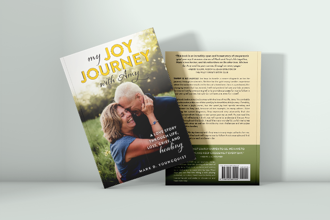
As the parking lot came into sight, I was overwhelmed with emotion thinking about how proud Amy would be of us for completing this goal. A year ago, I would never have imagined being able to spend four days and three nights in the wilderness, let alone walking forty-two miles. I can honestly say I enjoyed this trip more than the Porkies thanks to the company of my cousin Paul and the people we met along the way.
The Grand Staircase-Escalante National Monument awaits me at the end of September. I feel prepared for the trip, but I worry about the void that will be waiting for me upon my return. I have been razor focused on training and preparing for this one event. How will I deal with the emptiness afterward?
I am going to need a break both physically and mentally after this trip. My feet certainly need to recover from walking roughly 1,200 miles since Amy passed.
I am not sure what lies ahead for me in this new life I have been forced to architect. I imagine I am going to need to continue to rely on my friends and family as I walk this journey. But I know Amy would want me to embrace the joy of this challenge and soak in the beauty of the Grand Staircase-Escalante National Monument.
Miss you every day, Love.
This site is mine and mine alone. I will not tolerate trolls of any kind in the comment sections and will block negative comments and abusive individuals. Denigrating medical professionals will also not be tolerated on this site. Our health care system is far from perfect, but I have found the vast majority of health care workers to be competent and possessing a degree of empathy to be admired and emulated.
I’m proud of you, Mark!